 |
Madrid, Spain (SPX) Oct 18, 2010 Scientists at the Universidad Carlos III de Madrid (UC3M) have developed a new system for docking and capturing space satellites based on robotics and computer vision technology to autonomously guide a space vehicle to dock and capture the satellites. Within the framework of this research project, "Acoplamiento y Agarre de Satelites mediante Sistemas Roboticos basado en Vision (Docking and Capture of Satellites through computer vision) (ASIROV)", the scientists have developed algorithms and strategies to dock and capture a disabled satellite through the use of a space vehicle, called a "chaser", which autonomously carries out this function. "In this way", explained the head of this research study, Mohamed Abderrahim, who is from the UC3M Department of Automated Systems Engineering, "we attempt to carry out all the phases of a satellite inspection and maintenance mission with another autonomous vehicle equipped with a robotic system for capture and control". What is most outstanding about the designed prototype is its algorithmic part, according to the researchers, as they are not involved with the manufacture or launching of satellites. Their true contribution lies in the set of well-defined and ordered instructions which allow satellites to be programmed for the future so they can service others which have become disabled or which allow them to prolong the satellite's working life. These navigation algorithms, based on vision techniques, are capable of indentifying the objects of the search among various objects present, estimating their position and orientation. In their research, given that the system cannot be tested in a real platform, the scientists have constructed a small bank of tests which allow them to simulate a scenario of this kind. They first designed vision algorithms which employ satellite model vertices as characteristic points. Then, they perfected the technique to design a new vision algorithm that uses the information about the texture around the points of interest of the image to associate them with the points in the model. "The latter technique is quite robust against noise, changes in the background and variations in illumination", Abderrahim noted. Furthermore, he stated, "that the speed of the algorithm allows it to be used in real time". The idea behind this research came up thanks to the relation between the UC3M Robotics Lab and the engineers of the company GMV, which is dedicated to the space sector, and the existing need in the market for a system of this kind. "Today there is a growing need to provide satellite maintenance services, without relying on manned missions, which are very costly and involve risks. Robotics is the natural solution", Professor Abderrahim concluded.
Share This Article With Planet Earth
Related Links Universidad Carlos III de Madrid Space Tourism, Space Transport and Space Exploration News
 Sorting The Space Trash
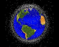
Sydney, Australia (SPX) Sep 24, 2010 We all sort our rubbish by category, allowing recycling to take place. It's easy to understand why. Different items require different processes for disposal. For years, we have been growing increasingly aware of the trash problem in low Earth orbit. Debris from whole satellites to tiny flecks of paint poses a hazard to anything we launch. It can damage spacecraft or even claim lives. With ... read more |
|
| The content herein, unless otherwise known to be public domain, are Copyright 1995-2010 - SpaceDaily. AFP and UPI Wire Stories are copyright Agence France-Presse and United Press International. ESA Portal Reports are copyright European Space Agency. All NASA sourced material is public domain. Additional copyrights may apply in whole or part to other bona fide parties. Advertising does not imply endorsement,agreement or approval of any opinions, statements or information provided by SpaceDaily on any Web page published or hosted by SpaceDaily. Privacy Statement |