 |
Tempe AZ (SPX) Mar 18, 2010 NASA is releasing to the Planetary Data System (PDS) the first six months of data acquired by the Lunar Reconnaissance Orbiter (LRO) spacecraft. The PDS serves as NASA's permanent online data archive providing these measurements to the science community and the world at large. This release includes data acquired between June 2009 and December 2009 by the suite of science instruments on the lunar orbiter, including the imaging system run by the ASU-based team under professor Mark Robinson. Approximately three million people have viewed pictures from the Lunar Reconnaissance Orbiter Camera (LROC) on the instrument's home page. The ASU team that oversees the LROC camera on the orbiter has regularly released captioned images with commentary from the professional lunar scientists on the LROC team. Additionally, the LROC team has "informally" released over 1400 NAC "pre-release" PDS format images to help interested users familiarize themselves with LROC data before the official release date. Beginning March 16, the complete set of science data from LROC's first six months consisting of more than 100,000 lunar images is available. The LROC EDR, short for Experimental Data Record release, includes 105,828 NAC and WAC products, totaling 10 Terabytes. The Calibrated Data Record, referred to as the CDR release, will be approximately 105,000 products, totaling 20 TBytes. An additional 9 TBytes of ancillary products will round out the release (total release 49.9 Tbytes). Each EDR and CDR product has an associated browse image and histogram of the observation Digital Numbers (pixel value). The browse image is a pyramidal TIFF file that is internally tiled with 256x256 tiles for rapid zooming. The layers are constructed by halving the resolution of the previous layer, starting with full resolution as the first layer until a layer is created with only one tile. Along with the EDR and CDR products, there is an INDEX.TAB file that contains information on each individual observation, the parameters commanded, estimated coordinates of the images on the lunar surface, lighting conditions, and other relevant information. "Both the LROC WAC and NAC datasets will be mined by the lunar exploration community for years to come in terms of basic science and mission planning," said Robinson, principal investigator of LROC and professor in the School of Earth and Space Exploration in ASU's College of Liberal Arts and Sciences. "Preliminary science results were presented in early March at the Lunar and Planetary Science Conference. However the LROC team has been so busy collecting this fundamental dataset that they have not even begun to scratch the surface in terms of scientific discovery." LROC acquires high-resolution images of the lunar surface from any spot on the surface with resolutions down to 50-cm meter while LRO orbits at a speed of 3,600 mph (5,800 km/hr). The imaging system consists of two Narrow Angle Cameras (NACs) to provide high-resolution images, a Wide Angle Camera (WAC) to provide images in seven color bands over a 60-km swath, and a Sequence and Compressor System supporting data acquisition for all three cameras. For at least the next seven months, LROC will collect thousands of color, black-and-white and ultraviolet images of the lunar surface, obtaining high-resolution coverage of about seven percent of the Moon's surface.
Share This Article With Planet Earth
Related Links LROC Mars News and Information at MarsDaily.com Lunar Dreams and more
 Solving A 37-Year Old Space Mystery
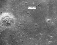
London, Canada (SPX) Mar 17, 2010 A researcher from The University of Western Ontario has helped solve a 37-year old space mystery using lunar images released yesterday by NASA and maps from his own atlas of the moon. Phil Stooke, a professor cross appointed to Western's Departments of Physics and Astronomy and Geography, published a major reference book on lunar exploration in 2007 entitled, "The International Atlas of Lu ... read more |
|
| The content herein, unless otherwise known to be public domain, are Copyright 1995-2010 - SpaceDaily. AFP and UPI Wire Stories are copyright Agence France-Presse and United Press International. ESA Portal Reports are copyright European Space Agency. All NASA sourced material is public domain. Additional copyrights may apply in whole or part to other bona fide parties. Advertising does not imply endorsement,agreement or approval of any opinions, statements or information provided by SpaceDaily on any Web page published or hosted by SpaceDaily. Privacy Statement |