In August 2005, engineers finished sealing an earthen barrier across the middle of what used to be the world’s fourth-largest lake. The Kok-Aral Dam, built by the Kazakh government with a $85 million loan from the World Bank, cut the northern lobe of the Aral Sea off from the southern one and held back the trickle of the Syr Darya river long enough for water to pool behind it. Within months, the water level in the North Aral rose by several metres. The southern lobe kept shrinking.
That is the short answer to the question. A modest dam — small by the standards of the Three Gorges or the Afsluitdijk — sealed off one half of a dying inland sea and let it refill from a single river. The other half, cut off from the Amu Darya by decades of Soviet cotton irrigation, went on evaporating. Today one shore has fishing boats again. The other has camels walking across salt.
The sea that Moscow drained
The Aral Sea sat on the border between Kazakhstan and Uzbekistan, fed by two rivers running down from the Pamir and Tien Shan mountains. In 1960 it covered roughly 68,000 square kilometres and held about 1,100 cubic kilometres of water. It was saline but productive. Fleets out of Aralsk and Moynaq pulled tens of thousands of tonnes of fish a year — carp, bream, pike-perch, Aral sturgeon.
Then Soviet planners decided Central Asia would grow cotton. Beginning in the 1960s, engineers cut canals off the Amu Darya and Syr Darya to irrigate fields in Uzbekistan, Turkmenistan and Kazakhstan. The Karakum Canal alone, stretching nearly 1,400 kilometres, siphoned off enough of the Amu Darya that by the 1980s the river often failed to reach the sea at all.
The lake did what any evaporating body of water does. It shrank, it split, and it got saltier. By 2000 the Aral had lost most of its volume. Salinity in the remaining water climbed past 100 grams per litre in places — nearly three times the concentration of the open ocean. Every commercial fish species died.
A cheap dam and a single river
The idea of walling off the northern lobe went back to the 1990s. A small sand dyke went up in the early 1990s and washed out by the end of the decade. The permanent replacement, the Kok-Aral Dam, was engineered as a 13-kilometre earthen embankment with a concrete spillway and completed with World Bank financing in August 2005.
The design was almost embarrassingly simple. The Syr Darya, the shorter and less abused of the two feeder rivers, still delivered several cubic kilometres of water a year to the northern basin. Without a dam that water spread across the seabed and evaporated. With a dam, it pooled.
The Kazakh fisheries agency measured the response within months. Water depth in the North Aral rose significantly within four years. Surface area expanded by roughly 20 percent. Salinity dropped from about 23 grams per litre to under 10 — brackish, but liveable for freshwater and euryhaline fish.
What came back
Fish came back first. Flounder, introduced in the 1970s as a hardy saltwater species, had survived the collapse. As salinity fell, the older native species returned from the delta and the tributaries — bream, roach, pike-perch, catfish, and the same carp that had disappeared from the markets a generation earlier.
By 2016, the fishing port of Aralsk was landing thousands of tonnes of fish a year. Processing plants reopened. A generation of fishermen who had grown up in a town 100 kilometres from the nearest water suddenly had boats to inherit again. The Kazakh government is now studying a second phase of the dam that would raise the water another few metres and bring the shoreline back within sight of Aralsk itself.
The recovery is not romantic. The North Aral is still a fraction of the pre-1960 sea, and the fish stocks are managed carefully to keep them from collapsing again. But a working ecosystem grew back on a body of water that scientists had written off two decades earlier.
What did not come back
South of the dam, the story kept going the way it had been going. The South Aral had been fed by the Amu Darya, and the Amu Darya was still being drained upstream for Uzbek cotton. By the mid-2000s the southern lobe had split again, into an eastern basin and a western basin. The eastern basin dried up completely in the summer of 2014 — the first time it had done so in around 600 years.
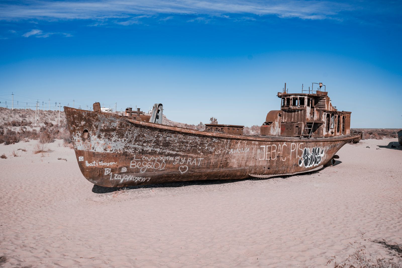
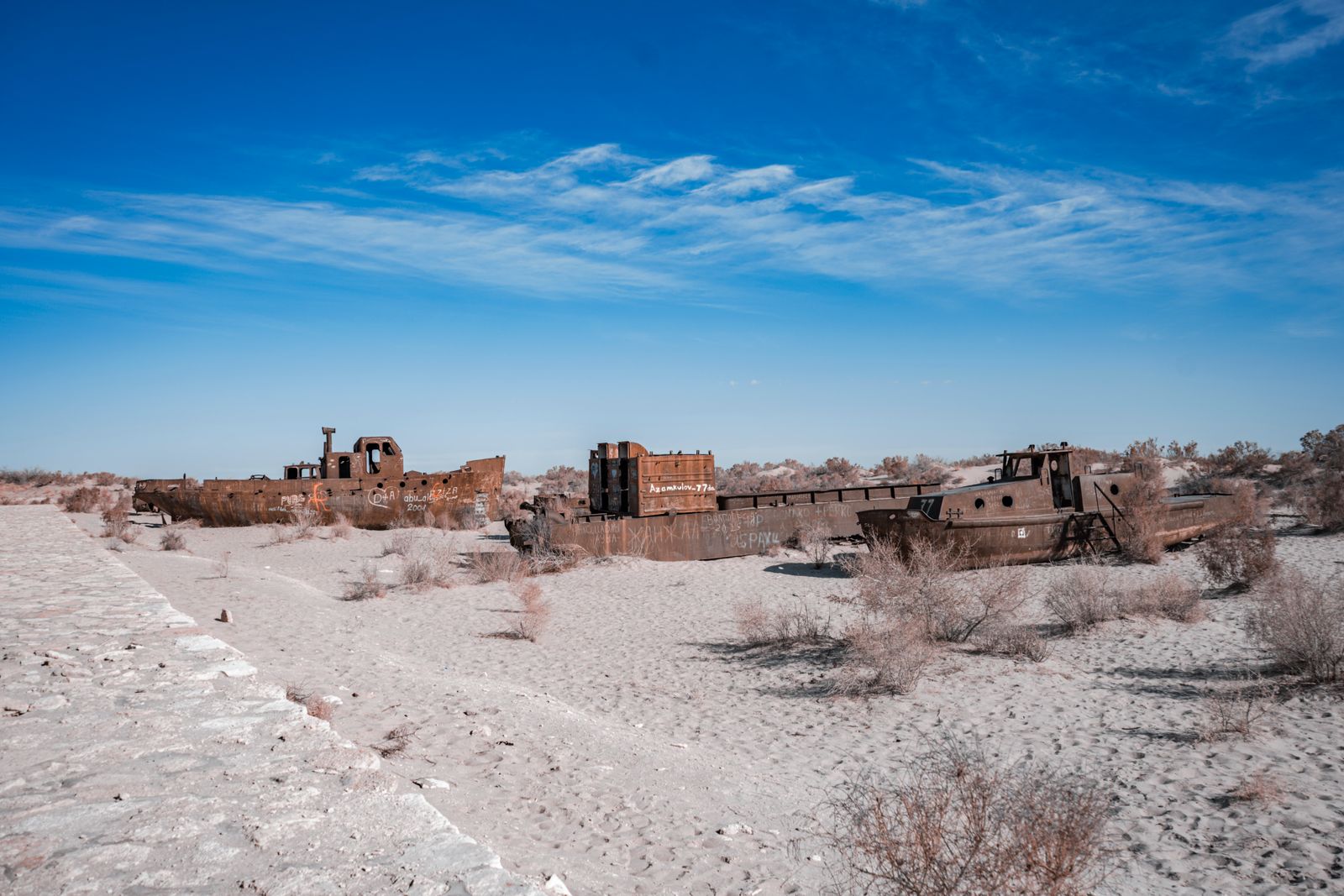
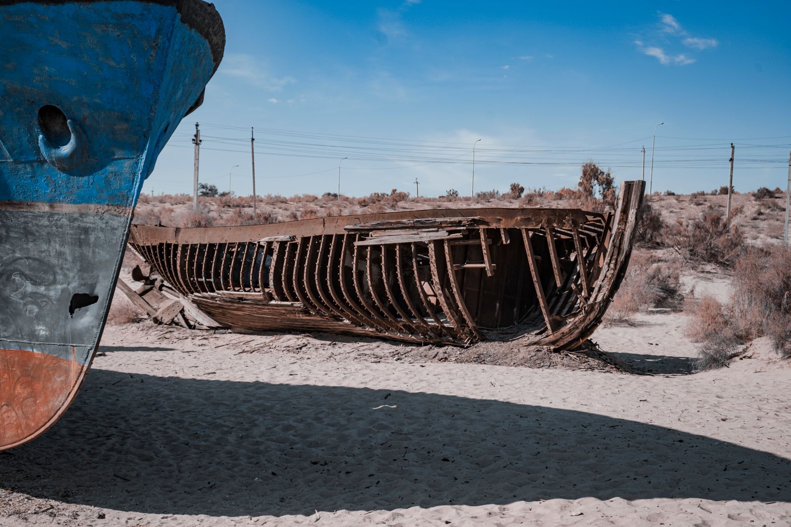
The western basin, deeper and narrower, hangs on as a hypersaline sliver against the Ustyurt Plateau cliffs. Salinity there is estimated above 100 grams per litre. Nothing commercial swims in it. Around Moynaq, the old Uzbek fishing town, ships sit on sand far from the nearest water. The dust that lifts off the exposed seabed carries pesticide residues, salt and heavy metals from half a century of irrigation runoff. Public health studies across Karakalpakstan continue to record elevated rates of respiratory illness, anaemia and infant mortality.
The asymmetry is stark. One dam, one river, one political decision on the Kazakh side of the border. Cotton economics and upstream water politics on the Uzbek side. Same lake, same climate, opposite trajectories.
Why the Dutch example keeps coming up
Engineers who work on inland-sea barriers keep pointing to one precedent: the Afsluitdijk, the dam that the Dutch closed across the Zuiderzee in 1932. That project, designed by Cornelis Lely, sealed off an arm of the North Sea and, over the following decades, converted it into the freshwater IJsselmeer, fed by the Rhine, Meuse and IJssel rivers.
Indian Prime Minister Narendra Modi visited the Afsluitdijk in 2025, and a Letter of Intent was signed between India’s Ministry of Jal Shakti and the Dutch Ministry of Infrastructure and Water Management for technical cooperation on Gujarat’s proposed Kalpasar project, a freshwater reservoir across the Gulf of Khambhat. Similar coastal-barrier studies are underway elsewhere; Singapore announced a protection study for its south-west coast starting in 2026.
The Afsluitdijk worked because the rivers behind it kept flowing. The Kok-Aral worked, on its smaller scale, for the same reason. The South Aral failed, and continues to fail, because the river behind it does not.
The physics of half a sea
A closed basin lake is a simple accounting problem. Water comes in from rivers and rain. Water leaves through evaporation. If inflow exceeds evaporation, the lake grows. If evaporation exceeds inflow, it shrinks and concentrates its salts.
The Aral basin loses roughly one metre of water per year to evaporation across its exposed surface. Rainfall in the region delivers only about 100 millimetres. Everything else has to come from the two rivers. When the Syr Darya delivers several cubic kilometres a year into a walled-off northern basin of a few thousand square kilometres, the arithmetic tips positive. When the Amu Darya delivers close to zero into an unwalled southern basin of tens of thousands of square kilometres, the arithmetic never comes close.
The dam did not create water. It created a container small enough for the water that was still arriving to matter.
What the split sea teaches
The Aral is often taught as an ecological parable — a warning about what happens when a river is drained to grow a thirsty crop in a dry place. The northern lobe complicates that lesson without erasing it. Recovery is possible. It is also partial, local, and dependent on someone upstream agreeing to leave the river alone.
Space Travel has written before about how mangrove forests store carbon at rates that dwarf tropical rainforests, and about the imagery from orbit that first documented the Aral’s collapse in the 1970s and 1980s. Satellite records from Landsat and later from the Sentinel programme are what let hydrologists watch the split in real time — one blue patch stabilising, the other patch fading to salt-white pixel by pixel through the 2010s.
From the ground, the difference is measured in trucks. Aralsk ships fish to Almaty by refrigerated freight. Moynaq ships tourists to a ship graveyard by bus.
The line on the map
The Kok-Aral Dam sits at about 46 degrees north, cutting east-to-west across what used to be open water. On satellite images it looks like a pencil line. To the north of the line, blue. To the south, ochre and white — dried seabed streaked with the tracks of the wind.
Fishermen in Aralsk still remember the years when there was nothing to fish. Their children go out on the water now. The salt plain on the other side of the dam is quieter, and getting quieter every year, and the wind picks up dust from it and carries it east across the steppe toward the towns that used to be ports.