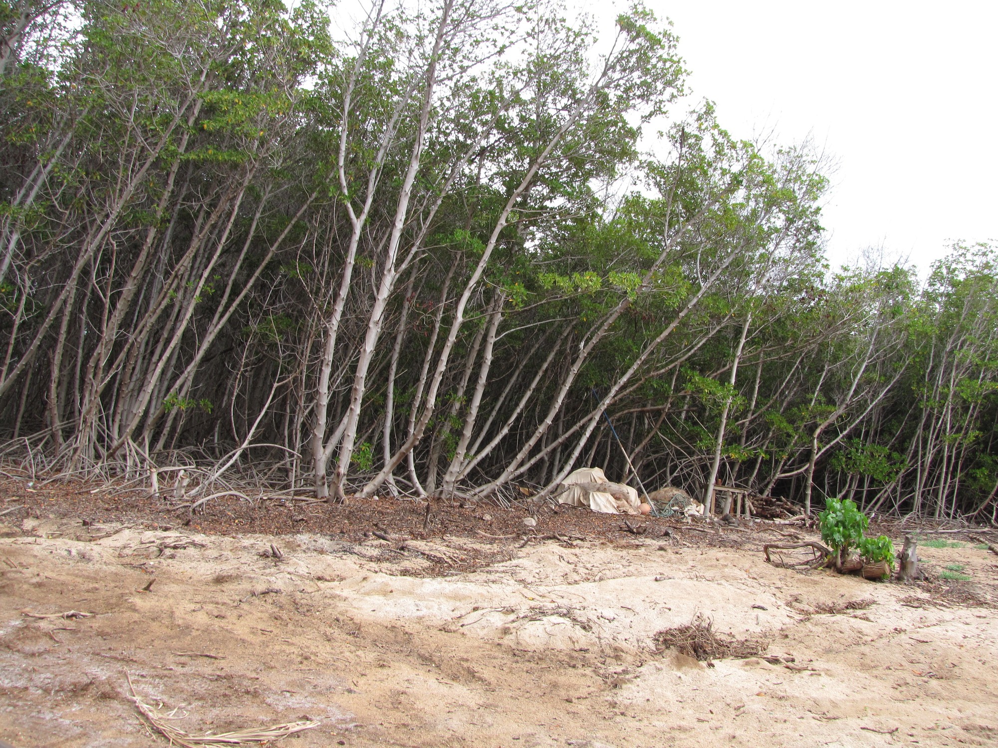
On a mudflat at Pālāʻau, on the southwestern coast of Molokai, an unreported number of Florida red mangrove propagules were pushed into Hawaiian silt in 1902. The planting was paid for and carried out by the American Sugar Company, the seed stock obtained from Florida through the U.S. Experiment Station, and the stated purpose was engineering rather than botany: hold the mud, stabilize a coastline that was receiving heavy silt loads from sugarcane cultivation upslope. That sequence of deeds is documented by Gerald Allen in the USDA Forest Service paper Invasive Mangroves and Coastal Change on Molokaʻi.
Ninety-nine years later, on a different island, the arithmetic of that decision could be traced in aerial photographs. Mapping Oʻahu’s shoreline stands by GIS from historical air photos, Chimner and colleagues reported in Pacific Science that the island’s mangrove cover stood at 146.57 hectares in 2001, up from 9.49 hectares in 1951 and 1952. Roughly 70 percent of the 2001 total, about 102 hectares, sat inside Pearl Harbor.
Rhizophora mangle is a tree that arrives in a place by floating there. Hawaiʻi, before the early 1900s, had received no such arrivals that took hold: the archipelago had no native mangrove species at all, a gap of some consequence given how thoroughly mangroves define tropical shorelines nearly everywhere else in the tropics.
A shipment of propagules, and a mudflat that needed holding
The southern coast of Molokai in 1902 was a working landscape under stress. Sugarcane cultivation moved soil, and the soil moved downhill, and the downhill end of that process was a shallow reef flat already threaded with Hawaiian fishponds. Planting mangroves was a plausible answer by the standards of the day. Red mangrove throws down prop roots that slow water, trap suspended sediment, and build substrate. That is precisely what the American Sugar Company wanted, and it is precisely what the trees did.
Allen’s account is careful about what is and is not known. The number of propagules planted was never reported. What is recorded is the origin (Florida), the route (the U.S. Experiment Station), the agent (the American Sugar Company), the target (mud flats on the southwestern coast), and the intent (stabilize coastal silt, protect against siltation). The USGS chapter on Molokaʻi follows the consequence forward: the trees did not stay where they were put. R. mangle became the dominant and by far the most successful of the mangrove species brought to Hawaiʻi in that era, spreading along the Molokai south coast and reaching other islands.
Nobody planted mangroves on Oʻahu in 1902 for the purposes measured a century later. Propagules travel on currents, and shorelines with fine sediment and sheltered water are exactly the habitat a red mangrove propagule is built to find.
9.49 hectares, then 146.57
The Oʻahu numbers are the cleanest expansion record available, because Chimner and colleagues built them from a consistent method applied to imagery across five decades. In 1951 and 1952, mapped mangrove cover on Oʻahu totaled 9.49 hectares. In 2001, it totaled 146.57 hectares. That is roughly fifteen times the earlier figure, accumulated over about half a century, on a single island, from a tree with no native presence in the archipelago a hundred years before.
The distribution matters as much as the total. Pearl Harbor alone held 102.24 hectares in 2001, about 70 percent of the island’s mapped mangrove. Pearl Harbor is a shallow, sheltered, sediment-rich estuarine system, which is to say it is close to ideal red mangrove habitat that happened to be sitting empty of mangroves for the entire prior history of the islands. When a colonizer with buoyant, self-planting seedlings encounters an unoccupied niche of that size, the hectare curve tends to look like the Oʻahu curve.
The consequences are coastal and physical. The USGS work on Molokaʻi documents change to the shoreline itself, with sediment accumulating in root systems and mangrove fronts advancing across flats, including encroachment into fishponds that were built and maintained as open, shallow water. Allen also notes, qualitatively, that conversion of open mudflat to closed mangrove forest degrades habitat quality for waterbirds such as the Hawaiian stilt, which forages on exactly the kind of bare, shallow flat that mangrove prop roots convert into forest floor.
What the map settles, and what it leaves open
A hectare map is a narrow instrument, and its narrowness is its value. The Chimner figures settle one question with precision: on Oʻahu, between the early 1950s and 2001, mapped mangrove cover went from 9.49 to 146.57 hectares, with roughly 102 of those hectares concentrated in Pearl Harbor. They do not constitute a statewide inventory, and no statewide hectare total should be read out of them. They do not quantify bird losses. They do not tell you how many propagules went into the mud at Pālāʻau in 1902, because that number was never written down.
What they do establish is persistence and direction. An introduction made for silt control on one island’s mudflats, by a sugar company, using seed stock shipped from Florida, produced a self-sustaining coastal forest that expanded on its own across decades and across water gaps. The 2001 Oʻahu figure of 146.57 hectares is not a projection or a model output. It is a measured area, drawn from photographs, of ground that a deliberate 1902 planting eventually reached.